Natural England
Kent and East Sussex: a 49 km stretch between Camber and Folkestone. The closing date for representations or objections is 5pm on 14 November 2014.
Norfolk: a 31 km stretch between Hopton-on-Sea and Sea Palling. The closing date for representations or objections is 5.30pm on 24 November 2014.
Cumbria: a 55 km stretch between Whitehaven and Silecroft. The closing date for representations or objections is 5pm, Wednesday 10 December 2014.
About coastal access
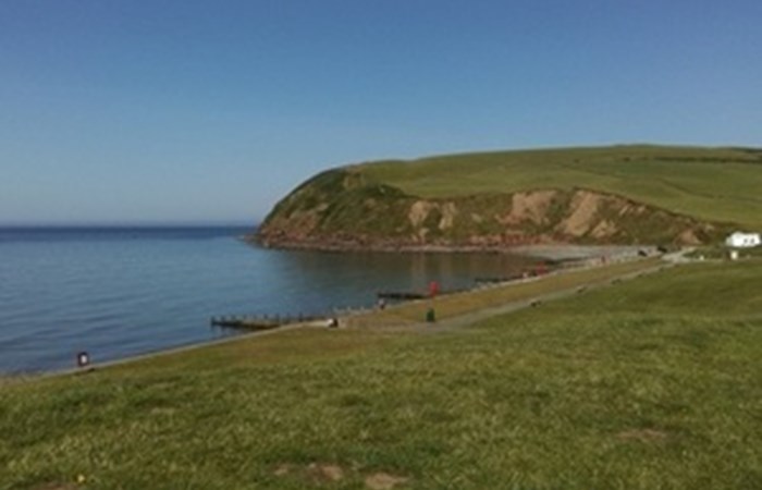
Work is underway to create a footpath around the entire coast of England. When completed, the England Coast Path will be 4,500km long and include new sections of coastline where people will be able to walk, rest and admire the view. It means that walkers will be able to arrive at our coast and turn left or right to enjoy a well-marked National Trail. It will be one of the longest coastal trails in the world. The route will join up existing coastal paths and for the first time, the route will be able to roll back where it erodes.
Teams are currently working in 6 areas around the country, on up to 3 stretches of route at a time. They follow a series of steps, to put the route in place.
Stage 1: local authorities and other key interests are approached when the stretch project team is ready to start work in their area
Stage 2: landowners are contacted and route proposals are discussed on the ground to identify the best line for the trail.
Stage 3: proposals for the route are drawn up and presented to the Secretary of State for Environment, Food and Rural Affairs for consideration. This also creates an 8 week window where objections or representations can be made on the plans. A public hearing may be held at the Planning Inspectors request, if objections are upheld and unresolved.
Stage 4: the route is approved by the Secretary of State. Work can then begin by the local authority to put the route markers, gates and other structures in place.
Stage 5: the route is opened to the public
This map shows where progress is being made on the route.