GovWire

Map: East marine plan areas map

Marine Management Organisation

January 23
14:05 2024

East Inshore and East Offshore marine plan areas

Request an accessible format.
If you use assistive technology (such as a screen reader) and need a version of this document in a more accessible format, please email communications@marinemanagement.org.uk. Please tell us what format you need. It will help us if you say what assistive technology you use.

Details

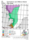
The map is indicative only and boundaries are subject to change as plan making starts in each area.

Shapefiles and data for all marine plan areas are available.

Published 11 June 2014
Last updated 23 January 2024 +show all updates
  1. Update 23-01-24

  2. First published.

Related Articles

Comments

  1. We don't have any comments for this article yet. Why not join in and start a discussion.

Write a Comment

Your name:
Your email:
Comments:

Post my comment

Recent Comments

Follow Us on Twitter

Share This


Enjoyed this? Why not share it with others if you've found it useful by using one of the tools below: