Environment Agency
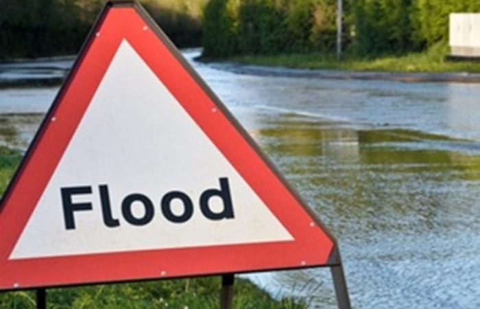
People are being urged to prepare for the threat of flooding as Storm Ciarn hits later this week.
Significant inland flooding across parts of England is possible from Wednesday to Friday, with some significant coastal impacts possible but not expected on Thursday. Wind is to the main concern, with wind-driven waves leading to risk of flooding on the south coast and coastline in Yorkshire and the North East at high tide.
However, the impacts are not currently expected to be on the scale of Storm Babet.
Ben Lukey, flood duty manager at the Environment Agency, said:
Large waves and onshore gales caused by Storm Ciarn mean significant flooding is possible along parts of the south coast on Thursday, with minor impacts possible more widely. Flooding is also possible along parts of the coasts of Yorkshire and the north east on Thursday.
Heavy rain from the storm could see significant surface water flooding from Wednesday evening to Friday and rivers flood on Thursday and Friday in parts of the south and the north east.
Environment Agency teams are out on the ground operating assets, working with partners and present in those communities that have experienced flooding, looking to minimise the impact on residents.
We urge people to stay safe on the coast and to remember to take extreme care on coastal paths and promenades. Flooding of low-lying coastal roads is also possible and people must avoid driving through flood water, as just 30cm of flowing water is enough to move your car.
People should check their flood risk, sign up for free flood warnings and keep up to date with the latest situation athttps://www.gov.uk/check-if-youre-at-risk-of-floodingand follow @EnvAgency on X, formerly known as Twitter, for the latest flood updates.
Met Office Chief Meteorologist Dan Suri, said:
Tomorrow, ahead of Storm Ciarn, a squally cold front will move eastwards across southern and southeast England bringing bursts of heavy rain and coastal gusts of 60-70mph, mainly from Dorset eastwards.
Wind and rain warnings associated with Storm Ciarn are in force from Wednesday night onwards into Friday, with further updates possible on Wednesday. These includeamber warning for windsfor southwestern parts of England and Wales Thursday early hours and morning and the far south and southeast of England Thursday daytime and early evening. Storm Ciarn is expected to bring very strong along southern coastal areas of England in particular where gusts of 70 to 80mph are possible, gusts perhaps exceeding 85 mph in the most exposed locations. Further inland, gusts could reach up to 50 or 60mph.
As well as strong winds, this deep low pressure system will bring heavy rain to many parts of the UK. Much of southern England and south Wales, as well as parts of north Wales, northeast England, southeast Scotland and perhaps the east of Northern Ireland look to see the wettest conditions between Wednesday evening and Friday morning. 20-25 mm of rain may fall quite widely, with 40-60 mm possible over higher ground. Some parts of south Wales and southwest England may see 80 mm of rain. This rain will fall on already saturated ground, bringing the risk of flooding.
From 7am on Friday 3 November, some Environment Agency staff are planning four days of industrial action. We are actively working to mitigate the risks for communities.
While Storm Ciaran will have passed by this point, risks still remain as water levels may be higher than normal as they flow through river catchments.
We will be operating our automated flood warning systems and we encourage people to continue to take heed of all flood alerts and flood warnings, and to call Floodline on 0345 988 1188 if they have any concerns
Visit Check for flooding - GOV.UK for current flood alerts and warnings and to check river, sea, groundwater and rainfall levels in your area and what to do in the event of a flood.
The Environment Agencys response to the flooding caused by Storm Babet saw an estimated 97,000 properties protected. Twenty high volume pumps and five small volume pumps were deployed across several sites. During the storm, the Environment Agencys flood warning service sent out more than 300,000 messages by email, telephone and text.
Tragically, a number of deaths have been widely reported and, sadly, the total number of properties reported to have been flooded during Storm Babet currently stands at 2,197. We will work to understand if more could be done to better protect these properties in future.
The Environment Agency worked round the clock with its partners to help reduce the risk. Teams operated flood defences, flood storage reservoirs and put up temporary barriers where needed to help protect communities.
The Government has also announced that support will be available to areas in England that have experienced exceptional localised flooding through the activation of theFlood Recovery Framework scheme.
The public shouldsign up to flood warningsandcheck the latest safety adviceas tidal flooding is possible and heavy downpours are likely to