Uk Space Agency
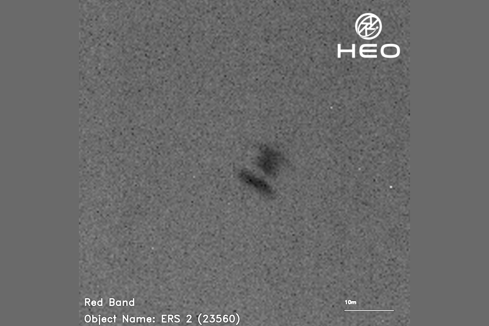
Captured from space by HEO an Australian company with an office in the UK the images taken by other satellites show ERS-2 as it rotates on its journey back to Earth. The UK Space Agency is working with HEO as part of ongoing research to support safe and sustainable space operations.
The images have been shared with the European Space Agency (ESA) who are tracking the re-entry of the ERS-2 satellite.
ERS-2 re-entering the atmosphere, photographed at 2:43pm UTC on 14 January 2024. Credit: HEO.
ERS-2 re-entering the atmosphere, photographed at 11:35pm UTC on 28 January 2024. Credit: HEO.
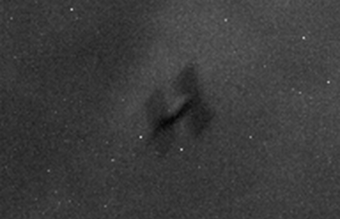
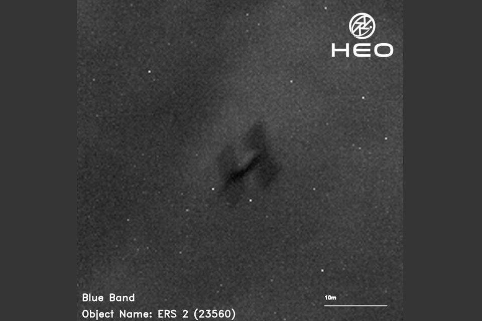
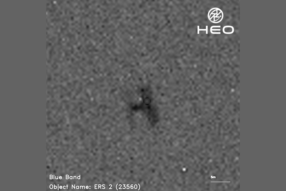
ERS-2 re-entering the atmosphere, photographed at 11:49pm UTC on 29 January 2024. Credit: HEO.
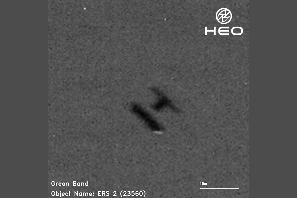
ERS-2 re-entering the atmosphere, photographed at 3:43am UTC on 3 February 2024. Credit: HEO.
Andrew Ratcliffe, Chief Engineer at the UK Space Agency, said:
Sustainability of the space environment is a key priority for the UK Space Agency. To support this, the Office of the Chief Engineer (OCE) performs research independently and with partners such as HEO, to help inform future policies and guidelines around safe and sustainable space operations.
It is interesting to see the initial results from this study imagery such as this, alongside other sources of ground based and in-orbit imagery, may help monitor future complex missions and refine re-entry predictions.
ERS-2 was the most sophisticated Earth observation satellite of its time,launching in 1995 and operating successfully for 16 years. It gathered data on the Earths land, oceans and polar ice caps, and helped to monitor the impacts of natural disasters, from floods to earthquakes.
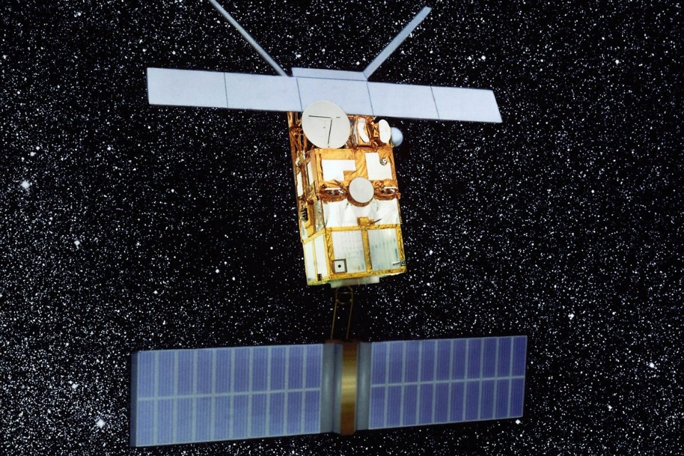
Artist's impression of ERS-2 in orbit. Credit: ESA.
UK scientists and engineers from organisations, including Astrium (now Airbus), the Rutherford Appleton Laboratory, Oxford University, the Mullard Space Science Laboratory and the Met Office, were involved in the satellites design, build and scientific instruments.
Angus Stewart, Head of Space Surveillance and Tracking at the UK Space Agency, said:
There are thousands of operational and defunct satellites in orbit around the Earth, and the ability to operate safely in space and bring the benefits back to Earth is growing increasingly challenging.
As well as capturing these images as part of our work with HEO, the UK Space Agency operates the UKs re-entry warning service and has tasked our UK sensors to observe the re-entry of ERS-2.
We share data with ESA and other international partners through the Inter-Agency Space Debris Coordination Committee (IADC) and other forums to support satellite re-entries.
William Crowe, CEO of HEO said:
HEO is adding a new data source at scale with Non-Earth Imaging (NEI). We know this technology is critical for removing debris actively in orbit and were excited to work with the UK Space Agency to test the effectiveness of NEI for determining where space debris will land when entering the atmosphere. This could transform the way we think about public safety when it comes to space.
Non-Earth Imaging (NEI) involves using space-based sensors to capture resolved imagery of Resident Space Objects (RSOs). These objects can include active or inactive spacecraft, rocket bodies and upper stages, or uncontrolled space debris. HEO uses fly-by inspections, where one satellite images another satellite as it flies past, as opposed to close-in inspection mission, which requires the imaging spacecraft to approach the RSO as a Rendezvous and Proximity Operation (RPO).